At a distance of 16 km from Munnar, Eravikulam National Park is a protected wildlife reserve located in Munnar. Situated on Munnar - Udumalpet Road, it is one of the popular national parks in Kerala, and among the must visit places during Munnar tour.

The Eravikulam National Park was established to protect the Nilgiri Tahr. Earlier, the area was managed as a game preserve by the Kanan Devan Hills Produce Company. The government of Kerala resumed control in 1971 and declared the Eravikulam-Rajamala Wildlife Sanctuary in 1975 and became a National Park in 1978.

The national park is spread across an area of 97sq. km and is a protected area. The park is extended into Tamil Nadu and is known as Annamalai Wildlife Sanctuary. This region is famous as the natural habitat of the endangered Nilgiri Tahr. Nearly half the world's population of this rare species is found in the area. Other faunal species found in the park are elephant Gaur, Giant Squirrel, Leopard, Lion-Tailed Macaque, Tiger, and Sambar. It is one of the beautiful places to see Neelkurnji flowers in South India as part of your wildlife tour in India.

The park is divided into 3 regions - the core area, the buffer area, and the tourism area. Visitors are allowed only to the tourism area, which is in the Rajamalai region. Tourists can take safari and trekking ...

...read more

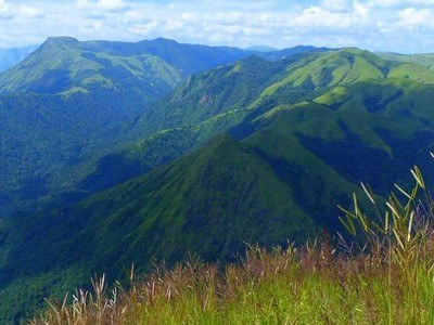
At a distance of 32 Kms from Munnar, Top Station is a breathtakingly beautiful place on Kerala - Tamilnadu boarder. From here, one can get 360 degrees view of the Western Ghats. This is one of the best Munnar tourist places and among the prime place to visit on a Munnar tour.

At an altitude of 2200 meters, this place is also known for the Neelakurunji Plant, which flowers only once every 12 years (next flowering year is 2018). The view point is at a distance of 2 kms from the road point and has to be trekked down. The trek path is very steep with deep valleys one side. One should be very careful while trekking to the view point, which offers lifetime memories. Top Station is the highest approachable road in South India.

The viewpoint at Top Station offers breathtakingly beautiful views of Kannan Devan Hills. The valleys all around, the misty mountains and distant waterfalls all make this place a must visit spot in Munnar.

Top Station is also a wonderful trekking destination in Munnar. There are multiple trekking routes in Top Station. The most popular route starts from Kurangani, a small village in Theni district of Tamilnadu. The total distance of Kurangani to Top Station is about 9 km and it usually takes around 6 hours to complete the trek. Camping is also allowed on the trail if overnight stay is preferred. This can also ...

...read more

At a distance of 40 Kms from Idukki, 38 Kms from Kumily, 57 Kms from Munnar, 15 Kms from Nadumkandam & 18 Kms from Kambam (on NH220 towards Palani), Ramakkalmedu is a lovely tourist place with rolling green hills and the fresh mountain air.

The hilltop also offers a panoramic view of the picturesque villages of Kambam and surrounding places on the slope of the Western Ghats. Kerala Tourism Department has provided additional facilities for tourists with resting points & statues of Kuravan & Kurathi (local tribes) at Ramakkalmedu.

Ramakkalmedu is also a great trekking destination. The view point on top of the hill is the highest point in this area, which can be reached by 3-4 Kms trek from the Ramakkalmedu Junction.

This place is connected by bus service from Munnar, Kottayam and Ernakulam.

...read more

About Chembra Peak


At a distance of 17 km from Kalpetta, Chembra Peak is a mountain peak in the Western Ghats of the Wayanad district. This is one of the top places for trekking in Kerala, and another popular attraction not to miss as part of your Wayanad tour packages.

Located at an elevation of 2100 m above sea level, Chembra is the highest peak in Wayanad & the third-highest peak in South India. The Chembra peak offers a panoramic view of not only the entire Wayanad district but also a large chunk of the Kozhikode, Malappuram, and Niligiri districts. The peak, its surrounding lush greenery, and the famed heart-shaped lake make it a paradise for travellers to explore.

Trekking to Chembra Peak


Trekking to Chembra Peak is one of the top things to do in Wayanad and is organized by Vana Samrakshana Samithi (VSS), a part of the forest department. Being nestled amidst the beautiful Wayanad hills and the adjoining Nilgiri hills, a trek to the peak is certainly a rejuvenating affair. The base of Chembra Peak is accessible by private vehicles from Meppadi town. Visitors can get permission from the entry gate itself. The peak is about 4 km one way and takes about 2 hours to trek (one way). The trek is a moderately difficult task and is recommended for trekkers with good physical fitness. There is a heart-shaped lake ...

...read more

At a distance of 6 km from Kodencheri, 32 km from Kalpetta, & 48 km from Kozhikode, Thusharagiri Falls is a scenic waterfall located in the Kozhikode district of Kerala, India. This is one of the most beautiful waterfalls in Malabar region and among the most popular places of sightseeing in Wayanad.

Thusharagiri literally means 'snowcapped mountains'. Two streams originating from the Western Ghats meet here to form the Chalippuzha River. The river diverges into three waterfalls creating a snowy spray, which gives the name - Thusharagiri. The highest of the three falls is the Thenpara Fall dropping from a height of 75 meters. The first waterfall can be reached easily while the remaining two falls can be reached from the first one by trekking through thick forest. A 5 km upstream trek will take one to the origin of the stream.

Widely known as the 'trekker's paradise', the place offers challenging trekking and rock-climbing opportunities. Surrounding the magical waterfalls are the evergreen forests and soothing streams adding to the pristine beauty. There is a trek path from Thusharagiri to Vythiri in Wayanad and it is not for the faint heart. Starting from Thusharagiri Falls in the morning, and reached Vythiri by evening. An ideal destination for nature lovers and wildlife enthusiasts, this Kerala waterfall is also a great picnic spot as well as a nice romantic retreat.

Considered among ...

...read more

At a distance of 3 km from Banasura Sagar Dam, 16 km from Kalpetta, and 41 km from Sulthan Bathery, Wayanad Adventure Camp is an eco-tourism site situated at Thariyod village near Kalpetta, Wayanad. It is one of the top places to visit as part of Wayanad tour packages.

Located in deep canopy shades of dense trees and a picturesque location,Wayanad Adventure Camp is locatedon the banks of the Karlad Lake, the second largest fresh water lake in Kerala.The Karlad Lake was formed after a landslide about two centuries ago. Spread across 11.5 acres, the lake in Thariyod Panchayat did not attract attention of tourism officials until recently. In 1998, a master plan was proposed after which basic facilities like camp and a garden were built here.Now the place has become a hub for adventure activities.

Wayanad Adventure Camp offers a wide range of activities for the adventure enthusiasts out there. The activities organized involve Kayaking, Zipline, Rock climbing, Boating, Nature walk,Commando Net, Burma Bridge, Tyre Walk, Hammock, and Bamboo rafting. Several indoor activities are also available like Carrom board, Ludo board, and Badminton. There's also a children's park nearby. Besides, one will get to witness stunning views from the hilltops.

The campsite offers you to stay in tents on a double or triple sharing basis depending on the availability. The property offers mattresses, pillows, and blankets to along ...

...read more

At a distance of 14 km from Sulthan Bathery, and 20 km from Kalpetta, Kolagappara is a remote village situated near Edakkal Caves in the Wayanad district of Kerala. It is one of the serene places for trekking in Kerala and among the best places for sightseeing in Wayanad.

Kolagappara boasts of tranquil surroundings that will provide a rejuvenating experience to visitors who take refuge here from the hustle and bustle of city life. One of the most prominent attractions of this place is the elephant-shaped rock that stands out in the whole landscape. Situated at an altitude of about 3000 feet, this astonishing rock has a flat place where more than five hundred people can stand at the same time. The sides of the rock that resemble an elephant's back can be deceitful. It is one of the best trekking spots in Wayanad.

Adventurous tourists can climb the rock. A 2-kilometer trek along a rough path will take you to the hilltop from where you can see the awesome view of Wayanad, including Krishnagiri Cricket Stadium, and the glimmering water level of the Kuripuzha reservoir. A mix of urban and green environment is found in this location that is spectacular during sunrise and sunset.

Timings: 6 AM - 6 PM

Entry: Free

...read more

At a distance of 5 km from Thekkady, Pandikuzhi is a fairytale-like place situated between Chellarkovil and the Tamil Nadu border. It is an ideal spot for trekking enthusiasts to indulge themselves and also for picnickers to enjoy some of the exotic flora and fauna as part of the Thekkady - Munnar tour packages.

The picturesque hill station of Pandikuzhi is endowed with lush greenery, a natural waterfall, and a myriad of flora and fauna. It is heaven for those travelers who love to indulge in nature and want to be one with a greenish environment. The area offers a variety of hiking trails, ranging from leisurely strolls to more challenging hikes, making it a perfect destination for nature enthusiasts and adventure seekers. The picturesque surroundings provide ample opportunities for photography, bird-watching, and picnicking.

Don't forget to visit the cascading waterfalls of Pandikuzhi. The waterfall, splashing from 1200 feet in height, is a sight to behold. The deep valleys, the exotic flora and fauna, the beautiful streams, the splashing waterfalls, the villages, and even the people around will make you stay here and visit this place again and again.

Timings: 24 Hours

Entry: Free

...read more

At a distance of 11 km from Kuttikkanam, and 45 km from Thekkady, Panchalimedu is a small hill station near Peerumedu in Idukki district in Kerala. It is an ideal spot for hiking in Kerala and among the top Thekkady tourist places.

Situated at an altitude of about 2,500 feet, Panchalimedu is known for its climate and viewpoint. The place is surrounded by deep valleys and hills, accompanied by meadows and grasslands. According to the legend, the Pandavas of Mahabharata along with their wife Panchali took shelter at Panchalimedu during their exile. Hence, the name Panchalimedu is derived from the words 'Panchali' meaning Draupadi, and 'medu' meaning hill.

There are two hills at Panchalimedu, one has a temple dedicated to Bhuvaneswari Devi. Several Shiva lingams, Trishulas (trident), and Naga idols are also placed near the temple. A small circular pond known as Panchalikulam is situated here, which is the place where Pandavas and Panchali take their daily bath. It is about 5 m in diameter. Even during hot summers, it will be filled with plenty of water. There is also a cave named Pandavaguha, in which the footprints of Bhima can be witnessed.

Panchalimedu is more of a soft hiking spot rather than a hiking trail that can be completed by elderly people and children. It is the perfect place to take a day off with your family. From Panchalimedu, one can see Mundakayam, Ponkunnam, Kanjirapally, ...

...read more

At a distance of 20 km from Munnar, Anamudi Peak is a mountain peak situated in the Western Ghats of Kerala near Munnar. It is the highest point in India outside the Himalaya-Karakoram, and among the popular places of trekking in Kerala.

Located at an altitude of 8842 feet, Anamudi Peak is the highest point in South India, and among the must-visit Munnar tourist places. Located inside the Eravikulam National Park, it is a famous trekking destination in Kerala which offers breathtaking views of the Western Ghats. Anamudi, together with the Eravikulam Park, is home to one of the largest surviving populations of Asian elephants, Gaurs, and Nilgiri Tahrs. Anamudi is also famous for Kurunji flowers that blossom once in 12 years.

The 2-3 days trekking programming starts at the foothill of Eravikulam with night halts at tribal hamlets inside the forest. Taking prior permission from Wildlife authorities is mandatory before starting the trek to Anamudi Peak during your Munnar tour. It is advisable to take guided tours from travel agents in Munnar, who will provide food, guide, accommodation, permissions, pick up / drop, and all other facilities.

In order to just view the Anamudi Peak from a distance, visitors can take the guided minibus tour of Eravikulam National Park which will take to the viewpoint that offers ...

...read more

At a distance of 12 km from Palakkad & 60 km from Coimbatore, Dhoni Hills is a famous picnic spot near Palakkad. It is one of the best places of sightseeing in Palakkad.

Adjacent to the Malampuzha Reservoir, Dhoni Hills is a wonderful destination for trekking. Dhoni is named after a boat-shaped rock on one of its hills, where thoni/dhoni means boat in Malayalam. It is famous for Dhoni Waterfalls and the Western Ghat forests. Visitors have to walk 4 km from the bottom of the hill to reach the waterfall.

Dhoni provides trekkers the opportunity to explore its hilly terrains. The trek from the base area to Malampuzha and Meenavallam and Dhoni waterfalls is very interesting. It is one of the famous trekking places near Coimbatore. One can encounter some rare species of flora and fauna on the trek here. Dhoni is also famous for its farmhouse, harboring hundreds of cattle of Swiss variety.

Timings: 6 AM - 6 PM

Entry: Rs. 100 for Person

...read more

At a distance of 10 km from Marmala Waterfalls, 30 km from Vagamon, and 57 km from Kottayam, Illikkal Kallu is a monolith located on top of the Illickal Mala near Meladukkam village in the Kottayam district of Kerala, India. It is one of the scenic viewpoints in the Western Ghats, and among the top places to visit during Vagamon tour.

Situated at an altitude of 3400 feet, Illikkal Kallu is a major tourist attraction in Moonnilavu and Thalanadu village of Meenachil taluk. Illikkal Kallu is one of the three hills comprising of Illikkal Mala, one of the highest peaks in the Western Ghats. Each of the hills has a peculiar shape. One of them resembles a mushroom, which is why it is known as Kuda Kallu (umbrella-shaped rock). The second hill has a small hunch on the sides and is therefore referred to as Koonu Kallu (hunch back rock). There are two bridges connecting the hills, known as Naragapalam (Hell bridge) and Swargavathil (Entrance to Heaven). A new rope-way is proposed connecting Illikal Kallu and the nearby hill Ilaveezha Poonchira, as a part of Kerala Tourism.

The beauty and the landscape of Illikkal Kallu are similar to that of the Pillar Rocks in Kodaikanal. Only one-half of the original rock remains, as the other half of the rock has fallen off. The view from Illikal Kallu is mesmerizing with numerous hills rising to the clouds and the deep valleys. From the hilltop, the Arabian Sea can be seen on the far ...

...read more

At a distance of 15 km from Kalpetta, and 39 km from Sulthan Bathery, Kurumbalakotta is a stunning viewpoint located in the Kottathara panchayath of Vythiri taluk in Wayanad district. It is one of the top places to visit as part of Wayanad packages.

Situated at an altitude of 3,251 feet, Kurumbalakotta is a monolithic hillock in Kerala. Geographically, the mountain is a part of the Deccan plateau and is the meeting point of the Western and Eastern Ghats. Kurumbalakotta is a favorite destination for trekkers as it offers a breathtaking view of sunrise and a 360-degree view of Wayanad. It is the only place in Wayanad that gives a view of almost half of the district.

One can opt for a jeep ride or go trekking up the viewpoint. The 2.5 km trek begins from Malankara, from which the hikers may have to walk their way up through bumpy and unpaved paths. The rocky way up the hill can take a lot of effort, but it is worth it when the peak is reached, which offers a breathtaking view of the mist-covered mountains like the Chembra Peak, Banasura Mala, and Ambukuthi Mala. The gorgeous view of the sunrise can be witnessed rising from the Chembra Peak, which can be spotted from this hillock.

There is also the Kurumbalakotta Kurushi Mala, which is closer to this viewpoint where the beautiful sunset can be seen in the evenings. There is also a newly constructed St. Jude's Church near the viewpoint. The high raised ceilings ...

...read more

At a distance of 15 km from Sulthan Bathery, and 22 km from Kalpetta, Cheengeri Mala, or Cheengeri Hills is a rocky hill located on the way to Kaduvakuzhi from Sultan Bathery. It is one of the popular places for trekking in Kerala and among the must-include places in Wayanad packages.

Positioned at an elevation of 2600 m, Cheengeri Hills is an adventure tourism hub developed by DTPC Wayanad. The hill's terrain offers a unique trekking experience due to its gentle slope and lack of dense forest cover. The 2 km trek route runs along the top of the rocks, providing an exhilarating journey for tourists. Tourists can scale the hills with the help of hanging ropes tied to the rocks.

The hilltop offers a mesmerizing view, especially during the morning hours when the sun rises, casting a magical light over the mist-covered landscape. From the top, visitors can enjoy panoramic views of various hill ranges in Wayanad, such as Ambukuthimala, Manikunnu, Phantom Rock, Kolgappara, Arattupara, and the Karapuzha Dam and River catchment area.

The rocky terrain surrounding Cheengeri Hills is ideal for rock climbing and rappelling activities. Additionally, camping in the hills allows travelers to immerse themselves in the tranquility of nature and admire the starlit sky. However, visitors must ensure they have the necessary camping equipment and permits for camping in this area.

Timings: 6 AM - 4 PM

Trekking ...

...read more
At a distance of 22 km from Munnar, Chokramudi Peak is a mountain peak in Munnar, Kerala. Situated between Bison Valley and Munnar, it is one of the highest peaks of Munnar and among the best places of trekking in Munnar.

Situated at an altitude of around 7,200 feet in Eravikulam National Park, the Chokramudi Peak stands isolated from other hill ranges but provide a fabulous view of the surrounding valleys & mountains covered with stunning dense forestation and the lush green tea plantations. One can also get a beautiful view of Anamudi Peak and Idukki Dam located nearby. Since it is located in Eravikulam National Park, the hill is filled with lush evergreen Shola forest, and the park is home to large number of animals such as Nilgiri Tahrs, Gaurs and Asian Elephants.

The Chokramudi Trek is a short and easy trek that can be done in a day. The trekking spot of Chokramudi is an ideal place for the amateur trekkers who wish to have an awesome beginning. The starting point of the trek is near Lockhart Tea Estate on Munnar - Bison Valley road which is an hour drive from Munnar and is indicated by a cross. From here, the trek can be of 3 to 5 hours covering a distance of 10 km upwards.

There are proper trekking trails to the top. The initial hike is a normal climb and then the hike is over the rocks until the top of the first peak, Kurisumala. From there Chokramudi is yet another stretch and the terrain might attain a bit more altitude and get tougher towards the ...

...read more

At a distance of 35 km from Munnar, Kolukkumalai Tea Estate is a sprawling tea plantation situated at Kottagudi village in the Theni district of Tamil Nadu. Located near Munnar, it is one of the most beautiful tea estates in India and among the must-visit places as part of Munnar tour packages.

At an altitude of 7900 feet, Kolukkumalai is the world's highest elevation tea plantation and one of the premier South Indian industries in India. This tea estate is a part of Tamil Nadu but Munnar is the most popular gateway to Kolukkumalai tea estate. The estate was built up by the British from 1920 to 1927 with the assistant of the Chettiar Brothers belonging to Bodinayakkanur, Tamilnadu, India. Sprawling over an area of 81 hectares, the estate was run by the Chettiar Brothers from 1935 to 1971. Thereafter, the Chettiar brothers transferred their rights to AJ Group in 1971.

The Kolukkumalai Tea Estate produces tea using the orthodox method in the time-tested tea factory which means that the tea is handpicked and goes through the seven-step process, including withering, rolling, sieving, fermenting, drying, fiber extraction, and grading. Kolukkumalai tea is one of the premium teas in South India as it possesses a special flavor and freshness because of the high altitude. The Kolukkumalai Tea has been a winner of the 'Golden Leaf' award given by UPASI (The United Planters' Association of Southern India) for the best quality ...

...read more

At a distance of 25 km from Munnar Bus Station, Meesapulimala is a mountain peak in the Western Ghats near Munnar, Kerala. Situated near Kolukkumalai Tea Estate, it is one of the highest peaks in the Western Ghats and among the popular places of trekking in Munnar.

At an altitude of 8,661 feet, Meesapulimalai is the second highest peak in the Western Ghats after Anamudi Peak. It is one of the most popular trekking places near Munnar, especially for ardent trekkers. Meesapulimala gets its name as the peak resembles a tiger's face. The mountain range is sandwiched between Annamalai Hills and the Palani Hills, which are located near Suryanelli. Considered as a hotspot of diversity, Meesapulimala has been recognized as a UNESCO world heritage site.

Meesapulimala is a must-go place for ardent trekkers. Meesapulimala is a trek through eight hills, passing through the shared border of Tamil Nadu and Kerala. This is one of the mesmerizing treks which will start at an altitude of 1500 m and gradually ascend to over 2600m that takes you through rivulets, shola and pine forests, expansive mountain ranges and rugged terrains. The sight from the top of the Meesapulimala hills is worth the visit. Besides, Meesapulimala is home to the Neelakurinji flowers that bloom once in every 12 years.

There are two popular trails to reach Meesapulimala. The shorter 8 kilometer-trek is through Rhodo Valley and the trek starts from the KFDC base camp whereas a longer 15 km trek is from ...

...read more

At a distance of 39 km from Munnar, Kallippara Sunset Point is a beautiful viewpoint situated at Vathikudy near Munnar, Kerala. It is one of the best viewpoints in Munnar and among the prime places to visit in Munnar.

If you like to go for an off-road drive, head towards Kallippara where you experience the panoramic views of orange-red sunset skies, Anayirangal Dam and the soaking mist. One can reach Kallippara on a 4WD jeep through the lush cardamom forests. The ride takes about 20 minutes and this is followed by a 30-minute trek uphill to the sunset point, which is one of the most adventurous activities to do in Munnar. Also, the uphill trek with the view of greenery interrupted with gushing streams in the valleys below, and a culmination at the Shola sunset point is an ecstatic activity. And, this is the perfect way to end your day.

Timings: 6 AM - 6 PM

Entry: Free

...read more

At a distance of 48 km from Trivandrum and 33 km from Ponmudi Bus Station, Varayadu Motta is a mountain ridge located in Ponmudi, Kerala. It is one of the popular places of trekking in Ponmudi.

Situated at a height of 1100 m, Varayadumotta is the highest peak in the Ponmudi ranges. Also known as Varayadumudi and Varayattumutti, the place derived its name from Nilgiri tahr / Varayadu, as this place is a favorable home for mountain goats (Nilgiri Tahr) in acute population. Varying elevation and peculiar shape of this hill is unique in the world. It is a protected mountain ridge situated in between Ponmudi hills, Palode (Brimore) hills, and Kallar valley. It includes 13 peaks and the second peak is the highest in Varayadumotta.

Varayudu Motta is the third adventurous trekking in South India after Meesapulimala and Agastyarkoodam. The trekking level can be from moderate to tough. Tough for first-timers, but they will never forget the experience for a long time. The ridge is a protected site under the Palode reserve forest and prior permission is required for the trekking. The permission can be obtained from the ecotourism units of Mankayam or Ponmudi by paying a fee for the trekking team. A forest guide will accompany the trekking team. Usually, trekkers climb the mountain and return to either Mankayam or Ponmudi. It is also possible to cross the entire ridge and reach the Kallar valley along the Ponmudi main road. However, this is a much tougher trek trail.


There ...

...read more

At a distance of 44 km from Ponmudi and 62 km from Trivandrum, Agasthyakoodam is a mountain peak situated near Ponmudi. It is one of the highest peaks in the Western Ghats and among the popular places of trekking in Kerala.

Perched at an altitude of 6201 feet, Agasthyarkoodam is the second highest peak in Kerala after Anamudi near Munnar (8842 feet), and among the best Ponmudi places to visit. The mountain is revered by both Buddhists and Hindus, as it is believed to be the abode of the Bodhisattva Avalokitesvara as well as of the sage Agastya, a disciple of Lord Shiva. There is a small shrine on the mountain top with an idol of Agasthya rishi and during the Agasthyarkoodam trekking season, people perform pujas here. The hill range is now declared as Agasthya Vanam Biological Park covering an area of 23 sq. km. Also, it is the source of River Kallar.

Apart from being a popular pilgrimage site, Agasthyakoodam is a paradise for ardent trekkers. It is a 20 km long trek which can be completed in 2-3 days. The trekking expedition starts from Bonocaud, a place situated around 30 km away from Ponumudi. The forest area of this trek is known for its remarkable flora and fauna, especially certain rare medicinal herbs which have been discovered here. Over 2000 species including lichens, orchids, mosses, and ferns have been recorded in the area. ...

...read more

At a distance of 13 km from Muthappanpuzha, 63 km from Kozhikode Railway Station and 33 km from Thiruvambady, Vellarimala is a mountain range in Kerala, spread across Thiruvambady Panchayat in Kozhikode district and Meppadi Panchayat in Wayanad district. It lies at an altitude of 2200 m and is a popular hill resort around Kozhikode.

Vellari Mala is part of the popular Camel's Hump Mountains of the Western Ghats. The tallest peak in this range is called Vavul Mala and is situated an altitude of 2339 m. The meandering flow of the River Chaliyar through the rocky terrain of the hill range adds to the mystic beauty of the place by creating many waterfalls and cascades. Vellari Mala is a trekker's paradise but it is also a great picnic spot for a relaxing experience with family and friends.

Trekking to Vellari Mala starts from Muthappanpuzha, 3 km from Anakkampoyil, which is about 50 km from Kozhikode. KSRTC Bus Services are available from Thiruvambady to Anakkampoyil and Muthappanpuzha. There are jeeps available to Vellari Mala base from Muthappanpuzha. From the base visitors need to trek 9 km through thick forest and rocky terrains. It will take one full day to climb this peak and one could return only on the next day.

Vellarimala trek is one of the toughest treks in the South. Except for the initial 4 km stretch, the entire trek is through dense forest, frequented by ...

...read more

At a distance of 7 km from Thirunelly Temple, 29 km from Mananthavady, 35 km from Irupu Falls & 52 km from Kalpetta, Pakshipathalam is an eco-tourist spot situated in the Brahmagiri hills of Wayanad district. Situated at an altitude of 1740 m, Pakshipathalam is one of the popular Wayanad tourist places and also one of the best places for trekking in Wayanad.

Pakshipathalam is the abode of large population of several species of birds. It is an ornithologist's paradise. The deep rock caves, formed among the thick blocks of rocks at the northern top end of the Brahmagiri, are the abode of various birds and wild beasts. The hill station of Pakshipathalam was once the meditating area for countless rishis or saints of ancient India. There is also a cave called Munikal Cave, where birds take shelter during night and early morning. The cave is also famous for the endangered species of birds known as 'Edible Nest Swift' which makes its nest with the help of its saliva. There is a small eagle shaped projection where the Garuda, the sacred vehicle of Lord Vishnu, was believed to have been landed.

Pakshipathalam is a challenging tourist spot for any adventure seeking tourist. This can be accessed only by trekking from Thirunelly Temple (about 8 km one way). The 3 hours trek to Pakshipathalam takes you through moist deciduous forests, rolling hillocks, open grasslands, slippery trails, and narrow rocky caves. There is also ...

...read more

No Destinations found for the selected filters

Top 5 Kerala Packages